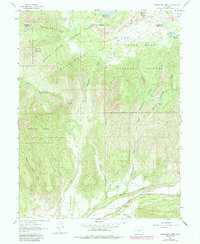
1960 Map of Hawxhurst Creek
USGS Topo · Published 1984About this map
Battlement Mesa and the northern reaches of Grand Mesa dominate this high-altitude landscape along the border of Garfield and Mesa counties. The 1960 field data captures a rugged ranching and resource environment defined by deep drainages like Smalley Gulch and Hawxhurst Creek. High-elevation water management is evident in the Battlement Reservoirs and McCurry Reservoir, while the remote nature of the terrain is marked by seasonal outposts such as Kennon Cow Camp and Hawxhurst Cow Camp.
Find a feature on this map
34 named features on this map. Tap any name to fly to it.
Don’t see what you’re looking for? This feature index may not catch every label — zoom into the map to look around manually.
Map Details
Editions of this 1960 Hawxhurst Creek Map
4 editions found
Other maps of this area

1929 · Grand Valley
USGS Topo · 1:62,500

1955 · Collbran
USGS Topo · 1:24,000

1955 · Molina
USGS Topo · 1:24,000

1955 · The Meadows
USGS Topo · 1:24,000

1956 · Grand Junction
USGS Topo · 1:250,000

1957 · Leadville
USGS Topo · 1:250,000

1959 · Grand Junction
USGS Topo · 1:250,000

1959 · Leadville
USGS Topo · 1:250,000

1960 · Leadville
USGS Topo · 1:250,000

1960 · Grand Junction
USGS Topo · 1:250,000