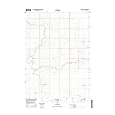
2015 Map of Haybarn Hill
USGS Topo · Published 2015About this map
Muskrat Cr meanders through the central landscape of this Fremont County quadrangle, carving a distinct hydrological pattern alongside Oil Springs Cr. The topography is defined by prominent elevations such as Haybarn Hill in the southwest and Deadman Hill to the east, illustrating the high-plains character of this Wyoming territory. Human activity is sparsely marked by the presence of Scotty Clark Rd, which traverses the terrain north of the creek. This survey provides a clear view of the drainage systems and land divisions during the early twenty-first century, useful for understanding water rights and natural landmarks in the region. The map also includes the upper reaches of Horseshoe Cr at the southern margin, completing the picture of the local watershed.
Find a feature on this map
10 named features on this map. Tap any name to fly to it.
Don’t see what you’re looking for? This feature index may not catch every label — zoom into the map to look around manually.
Map Details
Editions of this 2015 Haybarn Hill Map
This is the sole edition of this map. No revisions or reprints were ever made.
Other maps of this area

1951 · Fuller Reservoir
USGS Topo · 1:24,000

1951 · Shoshoni
USGS Topo · 1:24,000

1952 · Squaw Butte NE
USGS Topo · 1:24,000

1952 · Squaw Butte
USGS Topo · 1:24,000

1952 · Ocla Draw
USGS Topo · 1:24,000

1952 · Double Butte
USGS Topo · 1:24,000

1952 · Haybarn Hill
USGS Topo · 1:24,000

1952 · Butte Well
USGS Topo · 1:24,000

1953 · Campbell Ridge
USGS Topo · 1:24,000

1955 · Thermopolis
USGS Topo · 1:250,000