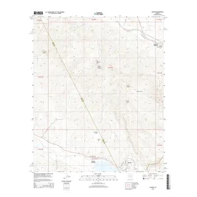
2014 Map of Hayden
USGS Topo · Published 2014About this map
The Gila River corridor serves as the primary southern landmark of this 2014 survey, where the concentrated development of Hayden meets the natural drainage of the Dripping Spring Mountains. The landscape is defined by dramatic elevation changes, notably at Steamboat Mtn and the prominent Tam O'Shanter Peak. Human settlement is focused along the state routes, with Hayden Junction and Dripping Springs providing key reference points in an otherwise arid expanse of canyons and flats. The Gila County and Pinal County line cuts diagonally across the rugged terrain, crossing through Schneider Canyon and near Haines Flat. To the northeast, the eponymous Dripping Spring Wash runs toward the settlement of Dripping Springs Valley, illustrating the critical role of seasonal water systems in this desert geography.
Find a feature on this map
25 named features on this map. Tap any name to fly to it.
Don’t see what you’re looking for? This feature index may not catch every label — zoom into the map to look around manually.
Map Details
Editions of this 2014 Hayden Map
This is the sole edition of this map. No revisions or reprints were ever made.
Other maps of this area

1910 · Ray
USGS Topo · 1:62,500

1911 · Winkelman
USGS Topo · 1:125,000

1913 · Winkelman
USGS Topo · 1:125,000

1915 · Christmas
USGS Topo · 1:62,500

1917 · Christmas
USGS Topo · 1:62,500

1949 · Holy Joe Peak
USGS Topo · 1:62,500

1949 · Crozier Peak
USGS Topo · 1:24,000

1949 · Winkelman
USGS Topo · 1:24,000

1949 · Winkelman
USGS Topo · 1:62,500

1949 · Saddle Mtn.
USGS Topo · 1:24,000