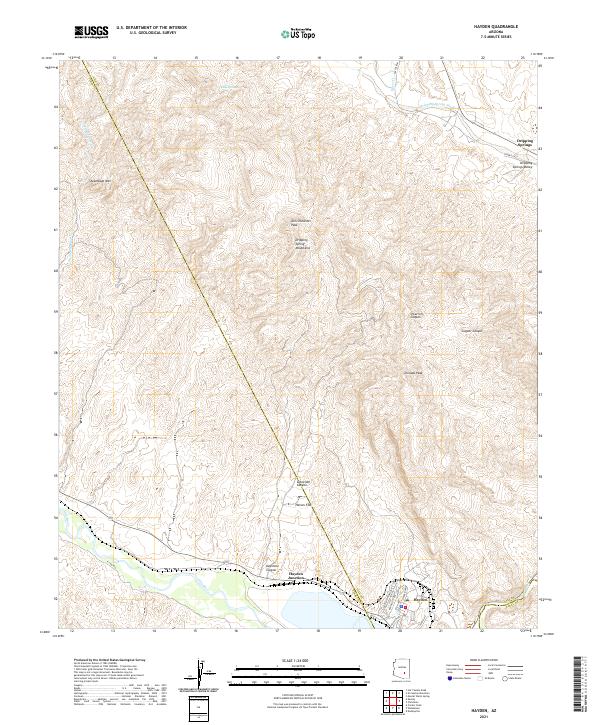
2021 Map of Hayden
USGS Topo · Published 2021About this map
The Gila River winds along the southern edge of this landscape, marking a sharp transition from the industrial and residential grid of Hayden to the formidable terrain of the Dripping Spring Mountains. This survey documents a region defined by its verticality and natural drainages, where peaks like Tam O'Shanter Peak and Tornado Peak overlook complex systems such as O'Carroll Canyon and Schneider Canyon. The settlement at Hayden shows a dense network of local streets including San Pedro Ave, Kennecott Ave, and Asarco Dr, reflecting the town's historical ties to the copper industry. Further north, the elevation drops into the Dripping Springs Valley, where the smaller community of Dripping Springs and Dripping Spring Wash are located. This map captures the intersection of industrial development at Hayden Junction with the expansive, undeveloped corridors of Haines Flat and Steamboat Wash.
Find a feature on this map
36 named features on this map. Tap any name to fly to it.
Don’t see what you’re looking for? This feature index may not catch every label — zoom into the map to look around manually.
Map Details
Editions of this 2021 Hayden Map
This is the sole edition of this map. No revisions or reprints were ever made.
Other maps of this area

1910 · Ray
USGS Topo · 1:62,500

1911 · Winkelman
USGS Topo · 1:125,000

1913 · Winkelman
USGS Topo · 1:125,000

1915 · Christmas
USGS Topo · 1:62,500

1917 · Christmas
USGS Topo · 1:62,500

1949 · Holy Joe Peak
USGS Topo · 1:62,500

1949 · Crozier Peak
USGS Topo · 1:24,000

1949 · Winkelman
USGS Topo · 1:24,000

1949 · Winkelman
USGS Topo · 1:62,500

1949 · Saddle Mtn.
USGS Topo · 1:24,000