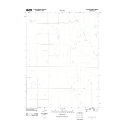
2011 Map of Hayes Center SW
USGS Topo · Published 2011About this map
Blackwood Creek defines the drainage patterns of this rural landscape in Hayes County, weaving through the eastern portion of the terrain. The topography is shaped by numerous small ephemeral water bodies and depressions typical of the Nebraska plains, reflecting the area's agricultural and pastoral character. Transportation is centered on a grid of section lines, with Old Hwy 17 and Hamlet Rd serving as the primary routes for local commerce and movement. This 2011 survey by the U.S. Geological Survey provides a precise view of the rural infrastructure and land management during the early 21st century, focusing on the hydraulic and transportation networks that support the region.
Find a feature on this map
3 named features on this map. Tap any name to fly to it.
Don’t see what you’re looking for? This feature index may not catch every label — zoom into the map to look around manually.
Map Details
Editions of this 2011 Hayes Center SW Map
This is the sole edition of this map. No revisions or reprints were ever made.
Other maps of this area

1954 · McCook
USGS Topo · 1:250,000

1957 · McCook
USGS Topo · 1:250,000

1958 · McCook
USGS Topo · 1:250,000

1973 · Dittons Creek NE
USGS Topo · 1:24,000

1973 · Suttlers Canyon West
USGS Topo · 1:24,000

1973 · Hayes Center NW
USGS Topo · 1:24,000

1974 · Hamlet
USGS Topo · 1:24,000

1974 · Dittons Creek SE
USGS Topo · 1:24,000

1974 · Hayes Center
USGS Topo · 1:24,000
1974 · Palisade NE
USGS Topo · 1:24,000