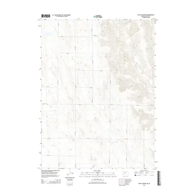
2014 Map of Hayes Center SW
USGS Topo · Published 2014About this map
Blackwood Cr meanders through the eastern portion of this Hayes County landscape, defining the local drainage pattern in an otherwise highly structured section-line grid. This area of Southwest Nebraska is characterized by its agricultural organization, with a network of numbered thoroughfares including Avenue 355, Road 740, and Avenue 353 providing access across the terrain. The map captures the intersection of natural topography and human geometry, where the winding course of the creek contrasts sharply with the straight-line routes of the local road system. For those interested in local land use and ownership patterns, the alignment of roads like Road 744 and Avenue 357 reveals the enduring influence of the Public Land Survey System on the Nebraska plains.
Find a feature on this map
15 named features on this map. Tap any name to fly to it.
Don’t see what you’re looking for? This feature index may not catch every label — zoom into the map to look around manually.
Map Details
Editions of this 2014 Hayes Center SW Map
This is the sole edition of this map. No revisions or reprints were ever made.
Other maps of this area

1954 · McCook
USGS Topo · 1:250,000

1957 · McCook
USGS Topo · 1:250,000

1958 · McCook
USGS Topo · 1:250,000

1973 · Dittons Creek NE
USGS Topo · 1:24,000

1973 · Suttlers Canyon West
USGS Topo · 1:24,000

1973 · Hayes Center NW
USGS Topo · 1:24,000

1974 · Hamlet
USGS Topo · 1:24,000

1974 · Dittons Creek SE
USGS Topo · 1:24,000

1974 · Hayes Center
USGS Topo · 1:24,000
1974 · Palisade NE
USGS Topo · 1:24,000