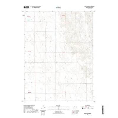
2017 Map of Hayes Center SW
USGS Topo · Published 2017About this map
Blackwood Cr winds through the eastern portion of this Hayes County landscape, defining the local drainage patterns across several townships including t7n r34w. The terrain is characterized by a series of north-south ridges and draws, reflected in the grid of section roads that provide access to the rural acreage. These corridors, such as Ave 354 and Ave 355, represent the essential infrastructure for agricultural life in this part of Nebraska.
Find a feature on this map
20 named features on this map. Tap any name to fly to it.
Don’t see what you’re looking for? This feature index may not catch every label — zoom into the map to look around manually.
Map Details
Editions of this 2017 Hayes Center SW Map
This is the sole edition of this map. No revisions or reprints were ever made.
Other maps of this area

1954 · McCook
USGS Topo · 1:250,000

1957 · McCook
USGS Topo · 1:250,000

1958 · McCook
USGS Topo · 1:250,000

1973 · Dittons Creek NE
USGS Topo · 1:24,000

1973 · Suttlers Canyon West
USGS Topo · 1:24,000

1973 · Hayes Center NW
USGS Topo · 1:24,000

1974 · Hamlet
USGS Topo · 1:24,000

1974 · Dittons Creek SE
USGS Topo · 1:24,000

1974 · Hayes Center
USGS Topo · 1:24,000
1974 · Palisade NE
USGS Topo · 1:24,000