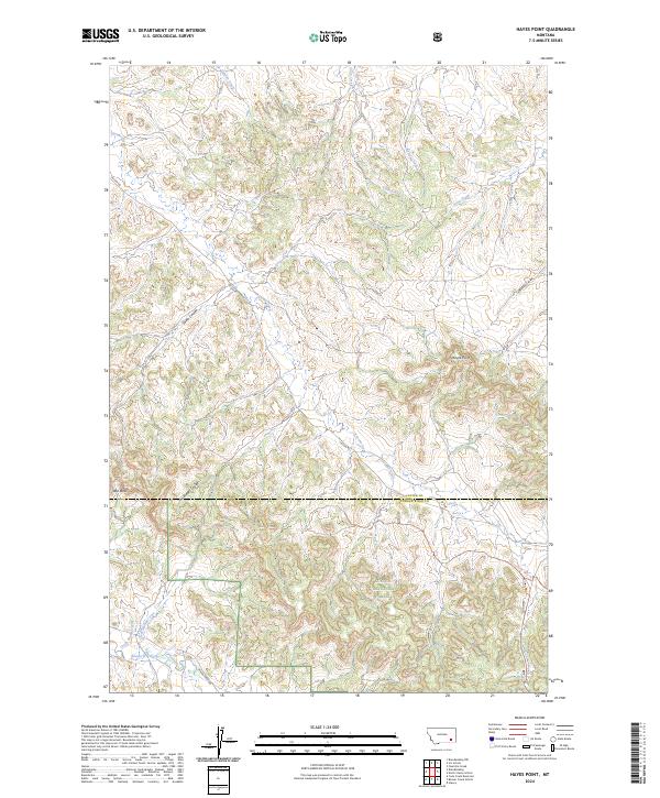
2024 Map of Hayes Point
USGS Topo · Published 2024About this map
Custer National Forest lands dominate this landscape along the border of Custer and Powder River counties. The terrain is defined by a dense network of drainages and topographical markers, including Hayes Point and the prominent Red Butte. This contemporary survey details a remote section of Montana where life follows the natural contours of the land, visible in the winding paths of The Breaks Coulee and Swain Coulee.
Find a feature on this map
25 named features on this map. Tap any name to fly to it.
Don’t see what you’re looking for? This feature index may not catch every label — zoom into the map to look around manually.
Map Details
Editions of this 2024 Hayes Point Map
This is the sole edition of this map. No revisions or reprints were ever made.
Other maps of this area

1954 · Hardin
USGS Topo · 1:250,000

1954 · Ekalaka
USGS Topo · 1:250,000

1956 · Ekalaka
USGS Topo · 1:250,000

1957 · Hardin
USGS Topo · 1:250,000

1958 · Ekalaka
USGS Topo · 1:250,000

1958 · Hardin
USGS Topo · 1:250,000

1965 · Ekalaka
USGS Topo · 1:250,000

1966 · Stacey
USGS Topo · 1:24,000

1966 · Beaver Creek School
USGS Topo · 1:24,000

1966 · Cook Creek Reservoir
USGS Topo · 1:24,000