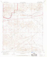
1963 Map of Hayfield
USGS Topo · Published 1969About this map
Joshua Tree National Monument anchors the northwestern corner of this desert landscape, where the Lost Palms Oasis provides a rare point of vegetation amidst the rocky terrain. The mid-century development of the California desert is clearly visible through the massive infrastructure of the Colorado River Aqueduct, which features a complex system of siphons, a Pumping Station, and the subterranean engineering of Hayfield Tunnel No 1. These water works skirt the southern edge of Hayfield Lake and Hayfield Valley, illustrating the industrial effort required to move water across the arid interior.
Find a feature on this map
49 named features on this map. Tap any name to fly to it.
Don’t see what you’re looking for? This feature index may not catch every label — zoom into the map to look around manually.
Map Details
Editions of this 1963 Hayfield Map
3 editions found
Other maps of this area

1940 · Frink
USGS Topo · 1:62,500

1940 · Cottonwood Spring
USGS Topo · 1:62,500

1940 · Iris Pass
USGS Topo · 1:62,500

1940 · Canyon Spring
USGS Topo · 1:62,500

1940 · Durmid
USGS Topo · 1:62,500

1943 · Canyon Spring
USGS Topo · 1:62,500

1943 · Coxcomb Mountains
USGS Topo · 1:62,500

1943 · Pinkham Well
USGS Topo · 1:62,500

1944 · Cottonwood Spring
USGS Topo · 1:62,500

1944 · Pinkham Well
USGS Topo · 1:62,500