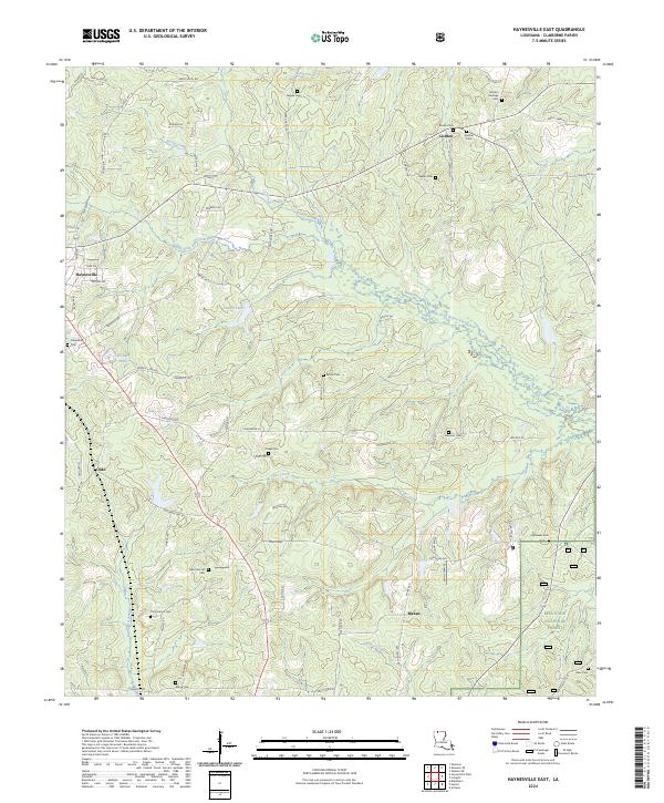
2024 Map of Haynesville East
USGS Topo · Published 2024About this map
The rolling Claiborne Parish landscape is defined by the winding course of the Middle Fork Bayou D'Arbonne and its numerous tributaries like Tiger Creek and Beaver Creek. Near the eastern edge of Haynesville, the terrain transitions into the protected woodlands of the Kisatchie National Forest. This modern survey reveals a countryside deeply rooted in its local heritage, evidenced by the high concentration of family and community burial grounds, such as Gordon Heritage Cem, Meadors Cem, and the Old Pine Hill Cem. Small settlements like Gordon and Mahan serve as local hubs for the surrounding farms and timberlands. Water features such as Campit Lake and Callender Pond are centers for local activity, while a network of rural roads like Henry Smith Rd and Ware Chapel Rd connect the dispersed homesteads across this piney woods region.
Find a feature on this map
80 named features on this map. Tap any name to fly to it.
Don’t see what you’re looking for? This feature index may not catch every label — zoom into the map to look around manually.
Map Details
Editions of this 2024 Haynesville East Map
This is the sole edition of this map. No revisions or reprints were ever made.
Other maps of this area

1951 · Summerfield
USGS Topo · 1:62,500

1952 · Homer
USGS Topo · 1:62,500

1953 · El Dorado
USGS Topo · 1:250,000

1955 · Shreveport
USGS Topo · 1:250,000

1956 · Shreveport
USGS Topo · 1:250,000

1957 · El Dorado
USGS Topo · 1:250,000

1958 · El Dorado
USGS Topo · 1:250,000

1960 · El Dorado
USGS Topo · 1:250,000
1971 · Emerson SE
USGS Topo · 1:24,000
1971 · Wesson SW
USGS Topo · 1:24,000