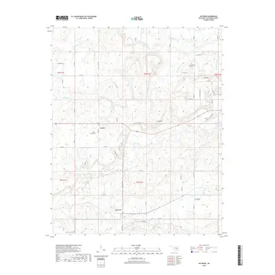
2018 Map of Haywood
USGS Topo · Published 2018About this map
The small communities of Haywood and Arpelar anchor this rural landscape in western Pittsburg County, where the terrain transitions from the lowlands of Big Wildhorse Cr to the prominent heights of Grubb Mtn and Pyle Mtn. This 2018 survey documents a region defined by a dense network of country roads and numerous small burial grounds that speak to the area’s genealogical history, including Arpelar Cem, Christian Hill Cem, and Hickory Grove Cem.
Find a feature on this map
51 named features on this map. Tap any name to fly to it.
Don’t see what you’re looking for? This feature index may not catch every label — zoom into the map to look around manually.
Map Details
Editions of this 2018 Haywood Map
This is the sole edition of this map. No revisions or reprints were ever made.
Other maps of this area

1896 · Coalgate
USGS Topo · 1:125,000

1898 · McAlester
USGS Topo · 1:125,000

1899 · Coalgate
USGS Topo · 1:125,000

1900 · Canadian
USGS Topo · 1:125,000

1900 · Wewoka
USGS Topo · 1:125,000

1900 · Coalgate
USGS Topo · 1:125,000

1909 · Mc Alester
USGS Topo · 1:125,000

1946 · Fort Smith
USGS Topo · 1:250,000

1950 · Mcalester
USGS Topo · 1:250,000

1954 · Oklahoma City
USGS Topo · 1:250,000