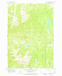
1963 Map of Hazard Lake
USGS Topo · Published 1978About this map
The Grass Mountains dominate this high-elevation landscape within the Payette National Forest, as it was recorded during a 1963 field check. The area is defined by a dense concentration of glacial cirque lakes and alpine basins, including uniquely named features like Coffee Cup Lake, Disappointment Lake, and Lake Serene. Drainage patterns are dictated by Hazard Creek and Hard Creek, which carve deep canyons such as Bascom Canyon as they move through the granite terrain. Human presence is minimal, represented primarily by the Hard Creek Guard Station and established campsites near Hazard Lake. A significant geographic boundary is visible in the south, where the border between Idaho County and Valley County crosses the high ridges near Bruin Mtn. This survey captures the wilderness character of the region before modern recreational development intensified, preserving the locations of remote meadows like Hard Creek Meadow.
Find a feature on this map
34 named features on this map. Tap any name to fly to it.
Don’t see what you’re looking for? This feature index may not catch every label — zoom into the map to look around manually.
Map Details
Editions of this 1963 Hazard Lake Map
3 editions found
Other maps of this area

1938 · Riggins
USGS Topo · 1:96,000

1945 · Riggins
USGS Topo · 1:125,000

1955 · Grangeville
USGS Topo · 1:250,000

1959 · Grangeville
USGS Topo · 1:250,000

1963 · Bally Mountain
USGS Topo · 1:24,000

1963 · Indian Mountain
USGS Topo · 1:24,000

1963 · Granite Lake
USGS Topo · 1:24,000

1963 · Black Tip
USGS Topo · 1:24,000

1963 · Hershey Point
USGS Topo · 1:24,000
1963 · Hazard Lake
USGS Topo · 1:24,000