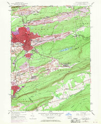
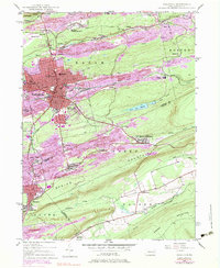
1947 Map of Hazleton
USGS Topo · Published 1970About this map
The anthracite coal heritage of Pennsylvania’s Middle Coal Field is etched into this landscape, centered on the urban core of Hazleton and West Hazleton. Strip mining scars and extensive rail networks from the Lehigh Valley and Central RR of New Jersey define the terrain, connecting numerous patch towns like Lattimer Mines and Beaver Meadows. Institutional life is well-documented through landmarks such as St Josephs Hospital, Hazleton State Hospital, and the High School on Diamond Avenue.
Find a feature on this map
62 named features on this map. Tap any name to fly to it.
Don’t see what you’re looking for? This feature index may not catch every label — zoom into the map to look around manually.
Map Details
Editions of this 1947 Hazleton Map
5 editions found
Other maps of this area

1889 · Hazleton
USGS Topo · 1:62,500

1891 · Wilkesbarre
USGS Topo · 1:62,500

1891 · Hazleton
USGS Topo · 1:62,500

1892 · Mahanoy
USGS Topo · 1:62,500

1893 · Hazleton
USGS Topo · 1:62,500

1893 · Mahanoy
USGS Topo · 1:62,500

1894 · Shickshinny
USGS Topo · 1:62,500

1894 · Wilkesbarre
USGS Topo · 1:62,500

1943 · Scranton
USGS Topo · 1:125,000

1944 · Newark
USGS Topo · 1:250,000