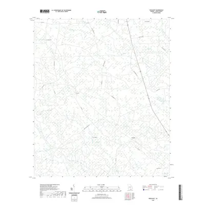
2020 Map of Headlight
USGS Topo · Published 2020About this map
Headlight and Ernest stand as small focal points within this wetland-dominated landscape of Clinch County. The terrain is defined by a dense network of blackwater drainages and shallow depressions known locally as bays, including Stalvey Bay, McGarrity Bay, and Lee's Bay. These features, alongside Cart Island Swamp, create an intricate mosaic of saturated soils and intermittent watercourses like Camp Br and Big Br. Human presence is marked by a grid of rural roads and isolated landmarks such as Hilliard Cem, suggesting a history of forestry or subsistence agriculture in the drier uplands like Crews Island and Cart Island. The layout of routes such as Old Homerville Rd and Colon Rd provides insight into the connectivity of these remote Georgia settlements before modern developments altered the character of the Okefenokee periphery.
Find a feature on this map
38 named features on this map. Tap any name to fly to it.
Don’t see what you’re looking for? This feature index may not catch every label — zoom into the map to look around manually.
Map Details
Editions of this 2020 Headlight Map
This is the sole edition of this map. No revisions or reprints were ever made.
Other maps of this area

1954 · Valdosta
USGS Topo · 1:250,000

1958 · Valdosta
USGS Topo · 1:250,000

1959 · Valdosta
USGS Topo · 1:250,000

1967 · Spooner
USGS Topo · 1:24,000

1967 · Colon
USGS Topo · 1:24,000

1967 · Fargo
USGS Topo · 1:24,000

1968 · Midway
USGS Topo · 1:24,000

1968 · Needmore
USGS Topo · 1:24,000

1968 · Headlight
USGS Topo · 1:24,000

1971 · Thelma
USGS Topo · 1:24,000