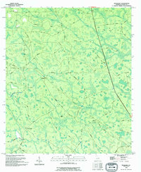
1994 Map of Headlight
USGS Topo · Published 1994About this map
Headlight stands as a focal point in this portion of Clinch County, where the landscape is defined by a complex network of wetlands and intermittent drainages. Small settlements like Melton and Ernest are situated along a web of rural routes, including the descriptively named Sawdust Pile Road and School Bus Road, suggesting the local importance of timber and community infrastructure. The geography is characterized by numerous bays and islands that rise slightly above the swampy terrain, such as McGarrity Bay, Crews Island, and Cart Island. Numerous small waterways like Sugar Branch and Coon Hollow Creek feed into larger systems, while a lone Cem (cemetery) near Stavey Bay provides a specific point of interest for genealogical research. The naming of roads like Fish Scaffold Road and Thelma Road reflects the personal and functional history of this coastal plain environment in the mid-1990s.
Find a feature on this map
63 named features on this map. Tap any name to fly to it.
Don’t see what you’re looking for? This feature index may not catch every label — zoom into the map to look around manually.
Map Details
Editions of this 1994 Headlight Map
This is the sole edition of this map. No revisions or reprints were ever made.
Other maps of this area

1954 · Valdosta
USGS Topo · 1:250,000

1958 · Valdosta
USGS Topo · 1:250,000

1959 · Valdosta
USGS Topo · 1:250,000

1967 · Spooner
USGS Topo · 1:24,000

1967 · Colon
USGS Topo · 1:24,000

1967 · Fargo
USGS Topo · 1:24,000

1968 · Midway
USGS Topo · 1:24,000

1968 · Needmore
USGS Topo · 1:24,000

1968 · Headlight
USGS Topo · 1:24,000

1971 · Thelma
USGS Topo · 1:24,000