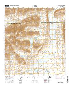
2016 Map of Healy B-2 NW
USGS Topo · Published 2016About this map
Nenana Glacier feeds a network of glacial runoff and mountain streams along the boundary between Denali Borough and Matanuska-Susitna Borough. This high-altitude landscape is defined by the braided path of the Nenana River, which dominates the eastern portion of the survey. In the western reaches, the terrain is carved by Wells Creek and the smaller Thief Cr, illustrating the complex drainage patterns of the Alaska Range. The presence of Siksik Lake provides a rare point of standing water amidst the steep elevation contours, marking a distinct geographical pocket in this otherwise fast-moving hydraulic system. The map serves as a detailed record of the intersections between township boundaries like t17s r2w and the natural flow of the glacial valleys.
Find a feature on this map
13 named features on this map. Tap any name to fly to it.
Don’t see what you’re looking for? This feature index may not catch every label — zoom into the map to look around manually.
Map Details
Editions of this 2016 Healy B-2 NW Map
This is the sole edition of this map. No revisions or reprints were ever made.
Other maps of this area

1949 · Healy C-3
USGS Topo · 1:63,360

1949 · Healy B-2
USGS Topo · 1:63,360

1950 · Healy B-3
USGS Topo · 1:63,360

1951 · Healy
USGS Topo · 1:250,000

1951 · Healy C-2
USGS Topo · 1:63,360
1952 · Healy B-3
USGS Topo · 1:63,360
1952 · Healy C-3
USGS Topo · 1:63,360

1952 · Healy B-2
USGS Topo · 1:63,360

1956 · Healy
USGS Topo · 1:250,000
2016 · Healy B-3 NE
USGS Topo · 1:25,000