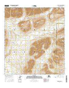
2016 Map of Healy B-3 NE
USGS Topo · Published 2016About this map
The Alaska Range defines the high-altitude character of this 2016 survey, where glacial runoff and steep drainages shape the local geography. The map documents the northern reaches of the Denali Borough as it meets the Matanuska-Susitna Borough boundary, illustrating a landscape primarily defined by water and ice. Major drainage systems like Wells Creek and its smaller tributary Thief Cr dominate the central topography, while Klunishana Cr cuts through the southern sections. This modern digital survey provides a precise look at the township and range divisions across this subarctic wilderness, capturing the intricate contours of the peaks and the shifting paths of braided mountain creeks.
Find a feature on this map
15 named features on this map. Tap any name to fly to it.
Don’t see what you’re looking for? This feature index may not catch every label — zoom into the map to look around manually.
Map Details
Editions of this 2016 Healy B-3 NE Map
This is the sole edition of this map. No revisions or reprints were ever made.
Other maps of this area

1949 · Healy C-3
USGS Topo · 1:63,360

1949 · Healy B-2
USGS Topo · 1:63,360

1950 · Healy B-3
USGS Topo · 1:63,360

1951 · Healy
USGS Topo · 1:250,000

1951 · Healy C-2
USGS Topo · 1:63,360
1952 · Healy B-3
USGS Topo · 1:63,360
1952 · Healy C-3
USGS Topo · 1:63,360

1952 · Healy B-2
USGS Topo · 1:63,360

1956 · Healy
USGS Topo · 1:250,000
2016 · Healy C-3 SW
USGS Topo · 1:25,000