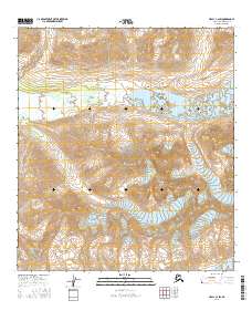
2016 Map of Healy C-2 SW
USGS Topo · Published 2016About this map
Yanert Glacier and the headwaters of the Yanert Fork dominate this high-altitude landscape in the Alaska-Denali Borough. The survey focuses on a glaciated corridor where ice and meltwater have carved deep paths through the terrain. The presence of Nenana Mtn and the edge of the Nenana Glacier at the southern boundary indicate a complex drainage system that feeds major Alaskan river systems. This 2016 data records the state of these glaciers and alpine streams like Edgar Cr at a specific moment in their geomorphological history, providing a baseline for researchers studying the evolving hydrologic patterns of the subarctic.
Find a feature on this map
11 named features on this map. Tap any name to fly to it.
Don’t see what you’re looking for? This feature index may not catch every label — zoom into the map to look around manually.
Map Details
Editions of this 2016 Healy C-2 SW Map
This is the sole edition of this map. No revisions or reprints were ever made.
Other maps of this area

1949 · Healy C-3
USGS Topo · 1:63,360

1949 · Healy B-2
USGS Topo · 1:63,360

1950 · Healy B-3
USGS Topo · 1:63,360

1951 · Healy
USGS Topo · 1:250,000

1951 · Healy C-2
USGS Topo · 1:63,360
1952 · Healy B-3
USGS Topo · 1:63,360
1952 · Healy C-3
USGS Topo · 1:63,360

1952 · Healy B-2
USGS Topo · 1:63,360

1956 · Healy
USGS Topo · 1:250,000
2016 · Healy C-3 NE
USGS Topo · 1:25,000