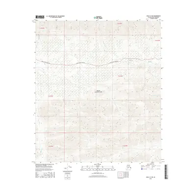
2016 Map of Healy C-5 NE
USGS Topo · Published 2016About this map
Denali National Park and its interior infrastructure are documented in this 2016 survey, focusing on the high-elevation wilderness of the Alaska Range. The primary corridor through this landscape is the Denali National Park Road, which winds across the northern half of the sheet, providing access to remote backcountry trailheads. Waterways like the Savage River in the west and Jenny Cr in the south carve through the steep topography, illustrating the drainage patterns that define this subarctic environment. Unlike many maps, this sheet emphasizes recreational and ecological features over human settlement. Significant hiking and pack routes are visible, including the Savage Alpine Trail and the Spring Trail. The map also captures several smaller drainages such as Hines Cr and Little Cr, providing a detailed view of the complex terrain within the park's protected boundaries.
Find a feature on this map
15 named features on this map. Tap any name to fly to it.
Don’t see what you’re looking for? This feature index may not catch every label — zoom into the map to look around manually.
Map Details
Editions of this 2016 Healy C-5 NE Map
This is the sole edition of this map. No revisions or reprints were ever made.
Other maps of this area

1950 · Healy D-4
USGS Topo · 1:63,360

1950 · Healy C-4
USGS Topo · 1:63,360

1951 · Healy
USGS Topo · 1:250,000

1951 · Healy D-5
USGS Topo · 1:63,360

1952 · Healy D-5
USGS Topo · 1:63,360

1952 · Healy C-5
USGS Topo · 1:63,360
1952 · Healy C-4
USGS Topo · 1:63,360
1952 · Healy D-4
USGS Topo · 1:63,360

1953 · Healy C-5
USGS Topo · 1:63,360

1956 · Healy
USGS Topo · 1:250,000