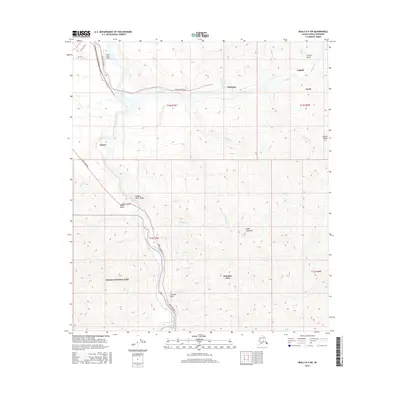
2016 Map of Healy D-4 SW
USGS Topo · Published 2016About this map
The Nenana River carves a path through the northern reaches of the Alaska Range, creating the dramatic Nenana River Gorge and serving as the primary corridor for transportation. This 2016 survey highlights the cluster of settlements including Healy, Usibelli, and Suntrana, where the local landscape is defined by coal mining and its proximity to Denali National Park. The Parks Highway and Healy Spur Road provide essential links between these mountain communities and the wider region.
Find a feature on this map
37 named features on this map. Tap any name to fly to it.
Don’t see what you’re looking for? This feature index may not catch every label — zoom into the map to look around manually.
Map Details
Editions of this 2016 Healy D-4 SW Map
This is the sole edition of this map. No revisions or reprints were ever made.
Other maps of this area

1950 · Healy D-4
USGS Topo · 1:63,360

1950 · Healy C-4
USGS Topo · 1:63,360

1951 · Healy
USGS Topo · 1:250,000

1951 · Healy D-5
USGS Topo · 1:63,360

1952 · Healy D-5
USGS Topo · 1:63,360

1952 · Healy C-5
USGS Topo · 1:63,360
1952 · Healy C-4
USGS Topo · 1:63,360
1952 · Healy D-4
USGS Topo · 1:63,360

1953 · Healy C-5
USGS Topo · 1:63,360

1956 · Healy
USGS Topo · 1:250,000