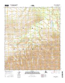
2016 Map of Healy D-5 SE
USGS Topo · Published 2016About this map
The Healy settlement area serves as a primary gateway to the northern reaches of Denali National Park in this 2016 survey. The terrain is defined by the high elevations of the Alaska Range, including the prominent Mt Healy and Black Diamond Peak. Transportation is centered on the Parks Highway, which runs north-south alongside the drainage of Dry Creek. This corridor supports local infrastructure such as Healy School Rd and Healy Spur Road. Nearby, Otto Lake provides a distinct water feature amidst the complex topography. The map illustrates the specific interface between the borough's developed roads and the protected wilderness boundaries, showing how local residents and visitors navigate the transition from town to the vast interior parklands.
Find a feature on this map
22 named features on this map. Tap any name to fly to it.
Don’t see what you’re looking for? This feature index may not catch every label — zoom into the map to look around manually.
Map Details
Editions of this 2016 Healy D-5 SE Map
This is the sole edition of this map. No revisions or reprints were ever made.
Other maps of this area

1950 · Healy D-4
USGS Topo · 1:63,360

1950 · Healy C-4
USGS Topo · 1:63,360

1951 · Healy
USGS Topo · 1:250,000

1951 · Healy D-5
USGS Topo · 1:63,360

1952 · Healy D-5
USGS Topo · 1:63,360

1952 · Healy C-5
USGS Topo · 1:63,360
1952 · Healy C-4
USGS Topo · 1:63,360
1952 · Healy D-4
USGS Topo · 1:63,360

1953 · Healy C-5
USGS Topo · 1:63,360

1956 · Healy
USGS Topo · 1:250,000