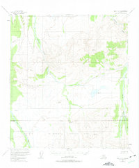
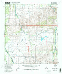
1954 Map of Healy D-6
USGS Topo · Published 1975About this map
Mt McKinley National Park Boundary cuts across the southern portion of this interior Alaska landscape, delineating the protected wilderness as it was surveyed in the early 1950s. The terrain is defined by the braided paths of the Teklanika River, Sushana River, and the Sanctuary River, which flow northward from the high ridges. This map captures a moment when human presence was limited to essential infrastructure, such as the Ranger Patrol Cabin located near the park's western perimeter. Numerous vertical angle bench marks, including Vabm 3428 Ridge and Vabm 2388 Flat, provide precise topographic data for this largely unsurveyed expanse of the Fairbanks Meridian, based on aerial photography from 1951.
Find a feature on this map
15 named features on this map. Tap any name to fly to it.
Don’t see what you’re looking for? This feature index may not catch every label — zoom into the map to look around manually.
Map Details
Editions of this 1954 Healy D-6 Map
5 editions found
Other maps of this area

1948 · Kantishna River
USGS Topo · 1:250,000

1950 · Fairbanks
USGS Topo · 1:250,000

1950 · Fairbanks A-5
USGS Topo · 1:63,360

1951 · Healy
USGS Topo · 1:250,000

1951 · Kantishna River
USGS Topo · 1:250,000

1951 · Fairbanks
USGS Topo · 1:250,000

1951 · Fairbanks A-5
USGS Topo · 1:63,360

1951 · Mount McKinley D-1
USGS Topo · 1:63,360

1951 · Healy D-6
USGS Topo · 1:63,360

1951 · Healy D-5
USGS Topo · 1:63,360