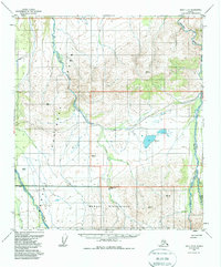
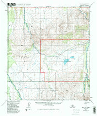
1954 Map of Healy D-6
USGS Topo · Published 1988About this map
Denali National Park and the expansive Denali Wilderness dominate this interior Alaskan landscape, surveyed in the early 1950s. The terrain is defined by the northward flow of major glacial meltwater systems, including the Sushana River, Teklanika River, and the East Fork Toklat River. Evidence of early administrative presence and backcountry management is visible through scattered Ranger Patrol Cabins positioned along these watercourses. This edition reflects the land-use designations established by the Alaska National Interest Lands Conservation Act, layering 1980s federal reservation boundaries over the mid-century topographic survey. A small portion of the Lignite R R corridor appears on the eastern edge, marking the intersection of the wilderness with the region's nascent industrial transport infrastructure.
Map Details
Editions of this 1954 Healy D-6 Map
5 editions found
Other maps of this area

1948 · Kantishna River
USGS Topo · 1:250,000

1950 · Fairbanks
USGS Topo · 1:250,000

1950 · Fairbanks A-5
USGS Topo · 1:63,360

1951 · Healy
USGS Topo · 1:250,000

1951 · Kantishna River
USGS Topo · 1:250,000

1951 · Fairbanks
USGS Topo · 1:250,000

1951 · Fairbanks A-5
USGS Topo · 1:63,360

1951 · Mount McKinley D-1
USGS Topo · 1:63,360

1951 · Healy D-6
USGS Topo · 1:63,360

1951 · Healy D-5
USGS Topo · 1:63,360