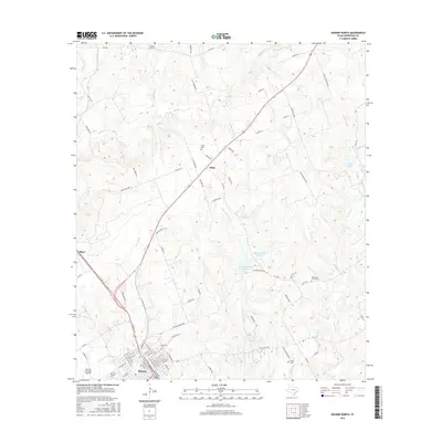
2016 Map of Hearne North
USGS Topo · Published 2016About this map
The city of Hearne serves as a focal point in this portion of Robertson County, where a grid of streets like E Main St and Cedar St give way to the expansive Hearne Municipal Airport on the southwestern edge. The landscape is defined by the dendritic drainage of Sandy Creek and Little Pin Oak Creek, creating a varied topography that has long shaped local settlement and agriculture. Small communities and named locales such as Elliot and Seger appear along the primary transit corridors, particularly following the path of Highway 79. For genealogists and local historians, the area is notably dense with burial sites, ranging from the Hammond Colony Cemetery to the Norwood Cemetery, preserving the locations of early family and community anchors. The inclusion of McGuire Lakes Number 1 and numerous smaller branches like Pukey Branch illustrates the complex hydraulic network supporting this part of the Texas Brazos Valley.
Find a feature on this map
98 named features on this map. Tap any name to fly to it.
Don’t see what you’re looking for? This feature index may not catch every label — zoom into the map to look around manually.
Map Details
Editions of this 2016 Hearne North Map
This is the sole edition of this map. No revisions or reprints were ever made.
Other maps of this area

1927 · Marquez
USGS Topo · 1:62,500

1930 · Marquez
USGS Topo · 1:62,500

1954 · Waco
USGS Topo · 1:250,000

1954 · Austin
USGS Topo · 1:250,000

1955 · Waco
USGS Topo · 1:250,000

1961 · Hearne North
USGS Topo · 1:24,000

1961 · Hearne South
USGS Topo · 1:24,000

1962 · Calvert
USGS Topo · 1:24,000

1962 · Wheelock
USGS Topo · 1:24,000

1962 · Hammond
USGS Topo · 1:24,000