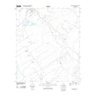
2010 Map of Hearne South
USGS Topo · Published 2010About this map
Hearne and its surrounding rural landscapes in Robertson County are defined by the winding course of the Brazos River and its tributary network. The southern periphery of the city transitions into agricultural plains marked by small settlements like Sutton, Tatsie, and Nicholas. A network of local roads including Old Mumford Rd and River Ridge Rd connects these communities, while the aviation history of the region is anchored by Hearne Municipal Airport and Corpora Airport.
Find a feature on this map
35 named features on this map. Tap any name to fly to it.
Don’t see what you’re looking for? This feature index may not catch every label — zoom into the map to look around manually.
Map Details
Editions of this 2010 Hearne South Map
This is the sole edition of this map. No revisions or reprints were ever made.
Other maps of this area

1954 · Austin
USGS Topo · 1:250,000

1956 · Bryan
USGS Topo · 1:62,500

1956 · Caldwell
USGS Topo · 1:62,500

1961 · Mumford
USGS Topo · 1:24,000

1961 · Hearne North
USGS Topo · 1:24,000

1961 · Hearne South
USGS Topo · 1:24,000

1962 · Goodwill
USGS Topo · 1:24,000

1962 · Calvert
USGS Topo · 1:24,000

1962 · Wheelock
USGS Topo · 1:24,000
1962 · Gause
USGS Topo · 1:24,000