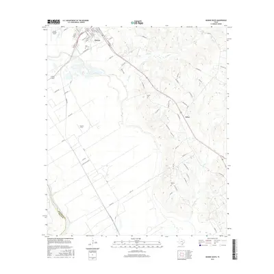
2016 Map of Hearne South
USGS Topo · Published 2016About this map
Hearne serves as the focal point for this survey of the Brazos River Valley, where the town's street grid reflects its importance as a rail-centered hub. Historically significant landmarks include Saint Luke Cem, Hearne Cem, and Galloway Cem, which provide essential touchstones for researchers tracking local family histories. The landscape transitions from the urban blocks of Hearne to the agricultural expanses and wooded drainage systems of Pin Oak Cr and Suggs Br to the east.
Find a feature on this map
70 named features on this map. Tap any name to fly to it.
Don’t see what you’re looking for? This feature index may not catch every label — zoom into the map to look around manually.
Map Details
Editions of this 2016 Hearne South Map
This is the sole edition of this map. No revisions or reprints were ever made.
Other maps of this area

1954 · Austin
USGS Topo · 1:250,000

1956 · Bryan
USGS Topo · 1:62,500

1956 · Caldwell
USGS Topo · 1:62,500

1961 · Mumford
USGS Topo · 1:24,000

1961 · Hearne North
USGS Topo · 1:24,000

1961 · Hearne South
USGS Topo · 1:24,000

1962 · Goodwill
USGS Topo · 1:24,000

1962 · Calvert
USGS Topo · 1:24,000

1962 · Wheelock
USGS Topo · 1:24,000
1962 · Gause
USGS Topo · 1:24,000