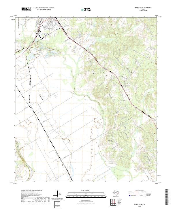
2022 Map of Hearne South
USGS Topo · Published 2022About this map
Hearne stands as the primary urban center in this Robertson County landscape, situated where the high ground begins its descent toward the Brazos River floodplain. The town's grid is dense with family-named streets like Anderson St and Hackberry St, reflecting its long-standing role as a regional hub. To the southeast, the small settlement of Sutton is positioned along the transit corridor of the Old Hearne Rd, surrounded by the winding drainage systems of Pin Oak Cr and Spring Cr.
Find a feature on this map
73 named features on this map. Tap any name to fly to it.
Don’t see what you’re looking for? This feature index may not catch every label — zoom into the map to look around manually.
Map Details
Editions of this 2022 Hearne South Map
This is the sole edition of this map. No revisions or reprints were ever made.
Other maps of this area

1954 · Austin
USGS Topo · 1:250,000

1956 · Bryan
USGS Topo · 1:62,500

1956 · Caldwell
USGS Topo · 1:62,500

1961 · Mumford
USGS Topo · 1:24,000

1961 · Hearne North
USGS Topo · 1:24,000

1961 · Hearne South
USGS Topo · 1:24,000

1962 · Goodwill
USGS Topo · 1:24,000

1962 · Calvert
USGS Topo · 1:24,000

1962 · Wheelock
USGS Topo · 1:24,000
1962 · Gause
USGS Topo · 1:24,000