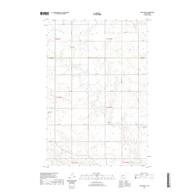
2020 Map of Heart Butte
USGS Topo · Published 2020About this map
Heart Butte rises above the plains in this part of western North Dakota, where the boundary between Morton County and Grant County divides a landscape defined by drainage basins and prairie section lines. The rural character of the region is punctuated by sites of local heritage, most notably the Saint Joseph Catholic Cem and the Old Saint Joseph Cem located near the southeastern corner of the quadrangle. These burial grounds, situated near the meandering path of Heart Butte Cr, serve as important markers for genealogists tracing early Catholic settlement in the area.
Find a feature on this map
30 named features on this map. Tap any name to fly to it.
Don’t see what you’re looking for? This feature index may not catch every label — zoom into the map to look around manually.
Map Details
Editions of this 2020 Heart Butte Map
This is the sole edition of this map. No revisions or reprints were ever made.
Other maps of this area

1938 · Heart Butte
USGS Topo · 1:48,000

1944 · Heart Butte
USGS Topo · 1:62,500

1954 · Bismarck
USGS Topo · 1:250,000

1958 · Bismarck
USGS Topo · 1:250,000

1960 · Dengate
USGS Topo · 1:24,000

1960 · Glen Ullin
USGS Topo · 1:24,000

1960 · Heart Butte NW
USGS Topo · 1:24,000

1960 · Heart Butte
USGS Topo · 1:24,000
1970 · Glen Ullin SW
USGS Topo · 1:24,000

1980 · Crown Butte Creek NW
USGS Topo · 1:24,000