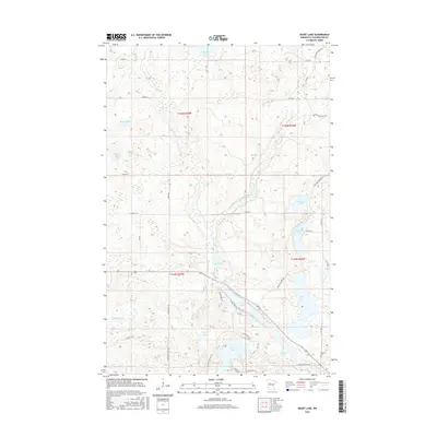
2016 Map of Heart Lake
USGS Topo · Published 2016About this map
Heart Lake and its surrounding wetlands anchor this Clearwater County landscape, where the transition from open water to marshy sloughs defines the local geography. The area around Stevens Gem is characterized by a high density of small lakes and seasonal basins, including Minerva Lake to the north and the connected waters of Sucker Lake and Long Lake to the south. This network of aquatic features is linked by Bear Cr and Sucker Cr, illustrating the complex drainage patterns of the Minnesota north woods.
Find a feature on this map
46 named features on this map. Tap any name to fly to it.
Don’t see what you’re looking for? This feature index may not catch every label — zoom into the map to look around manually.
Map Details
Editions of this 2016 Heart Lake Map
This is the sole edition of this map. No revisions or reprints were ever made.
Other maps of this area

1954 · Bemidji
USGS Topo · 1:250,000

1957 · Bemidji
USGS Topo · 1:250,000

1958 · Bemidji
USGS Topo · 1:250,000

1969 · Anchor Hill
USGS Topo · 1:24,000

1969 · Long Lost Lake
USGS Topo · 1:24,000
1969 · Zerkel
USGS Topo · 1:24,000

1969 · Heart Lake
USGS Topo · 1:24,000
1969 · Zerkel NW
USGS Topo · 1:24,000
1969 · Upper Rice Lake
USGS Topo · 1:24,000

1972 · Alida
USGS Topo · 1:24,000