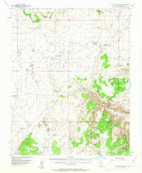
1954 Map of Heaton Knolls
USGS Topo · Published 1963About this map
Red Blanket Ranch and a sparse network of livestock water sources define this high desert landscape on the Arizona Strip during the mid-1950s. The terrain is dominated by dramatic geological transitions, from the flat expanse of Upper Clay Hole Valley to the uplifted Yellowstone Mesa. Water management is the primary evidence of human activity, represented by numerous isolated catchments like Heaton Reservoir, Earl Reservoir, and June Tank.
Find a feature on this map
48 named features on this map. Tap any name to fly to it.
Don’t see what you’re looking for? This feature index may not catch every label — zoom into the map to look around manually.
Map Details
Editions of this 1954 Heaton Knolls Map
3 editions found

Other maps of this area

1886 · Mt. Trumbull
USGS Topo · 1:250,000

1886 · Kaibab
USGS Topo · 1:250,000

1892 · Mt. Trumbull
USGS Topo · 1:250,000

1953 · Grand Canyon
USGS Topo · 1:250,000

1954 · Heaton Knolls NW
USGS Topo · 1:24,000

1954 · Lost Spring SE
USGS Topo · 1:24,000
1954 · Short Creek SW
USGS Topo · 1:24,000

1954 · Short Creek SE
USGS Topo · 1:24,000

1954 · Heaton Knolls SE
USGS Topo · 1:24,000

1954 · Fredonia SW
USGS Topo · 1:24,000