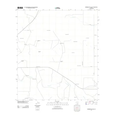
2013 Map of Hebbronville SE
USGS Topo · Published 2013About this map
Water infrastructure and ranching outposts define this stretch of South Texas in the Jim Hogg County brushlands. The landscape is primarily organized around essential water sources, with family-named or descriptive landmarks such as Gutierrez Windmill, Agua Negra Windmill, and Rancho Viejo Windmill scattered across the arid terrain. These points signify the vital relationship between groundwater and ranching operations in this region, where the few natural drainage ways like Palo Blanco Cr and Laborcitas Cr carve subtle paths across the land.
Find a feature on this map
29 named features on this map. Tap any name to fly to it.
Don’t see what you’re looking for? This feature index may not catch every label — zoom into the map to look around manually.
Map Details
Editions of this 2013 Hebbronville SE Map
This is the sole edition of this map. No revisions or reprints were ever made.
Other maps of this area

1921 · Falfurrias
USGS Topo · 1:125,000

1956 · Laredo
USGS Topo · 1:250,000

1967 · Hebbronville SE
USGS Topo · 1:24,000

1967 · Realitos
USGS Topo · 1:24,000

1967 · Hebbronville NW
USGS Topo · 1:24,000

1967 · Hebbronville
USGS Topo · 1:24,000

1968 · Palomas Ranch NW
USGS Topo · 1:24,000

1968 · Concepcion NW
USGS Topo · 1:24,000
1969 · Ramirez
USGS Topo · 1:24,000
1972 · Baluarte Ranch
USGS Topo · 1:24,000