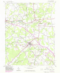
1942 Map of Hebron
USGS Topo · Published 1983About this map
Hebron serves as the central hub of this Eastern Shore landscape, situated where local roads converge near the Conrail line. The terrain is defined by a dense network of slow-moving waterways that drain the flat Atlantic Coastal Plain, including Porter Mill Creek and Quantico Creek. These streams are frequently punctuated by small bodies of water such as Baron Pond and Mockingbird Pond, reflecting a landscape heavily influenced by millwork and natural drainage patterns.
Find a feature on this map
23 named features on this map. Tap any name to fly to it.
Don’t see what you’re looking for? This feature index may not catch every label — zoom into the map to look around manually.
Map Details
Editions of this 1942 Hebron Map
2 editions found
Other maps of this area

1901 · Salisbury
USGS Topo · 1:62,500

1903 · Nanticoke
USGS Topo · 1:62,500

1905 · Hurlock
USGS Topo · 1:62,500

1915 · Seaford
USGS Topo · 1:62,500

1942 · Wetipquin
USGS Topo · 1:24,000

1942 · Mardela Springs
USGS Topo · 1:24,000

1942 · Eden
USGS Topo · 1:24,000

1942 · Hebron
USGS Topo · 1:24,000

1942 · Salisbury
USGS Topo · 1:24,000

1942 · Delmar
USGS Topo · 1:24,000