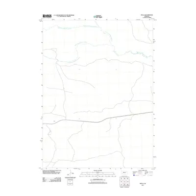
2011 Map of Hecla
USGS Topo · Published 2011About this map
Hecla sits along the southern edge of this Hooker County landscape, defined by the winding network of the Sandhills' water systems. The map details the intricate convergence of the Middle Branch Middle Loup River, the North Branch Middle Loup River, and the South Branch Middle Loup River as they join to form the main Middle Loup River. This drainage pattern illustrates the hydrologic character of the Nebraska region, where these branches carve through the terrain before uniting in the eastern portion of the quadrangle. The sparse development outside of the primary settlement reflects the open, ranching-oriented geography of the area in the early 21st century.
Find a feature on this map
5 named features on this map. Tap any name to fly to it.
Don’t see what you’re looking for? This feature index may not catch every label — zoom into the map to look around manually.
Map Details
Editions of this 2011 Hecla Map
This is the sole edition of this map. No revisions or reprints were ever made.
Other maps of this area

1947 · Dismal River Ranch
USGS Topo · 1:62,500

1948 · Carr Lake
USGS Topo · 1:62,500

1948 · Mullen
USGS Topo · 1:62,500

1949 · Dismal River Ranch
USGS Topo · 1:62,500

1950 · Carr Lake
USGS Topo · 1:62,500

1950 · Hire
USGS Topo · 1:62,500

1951 · Mullen
USGS Topo · 1:62,500

1954 · North Platte
USGS Topo · 1:250,000

1956 · North Platte
USGS Topo · 1:250,000

1957 · North Platte
USGS Topo · 1:250,000