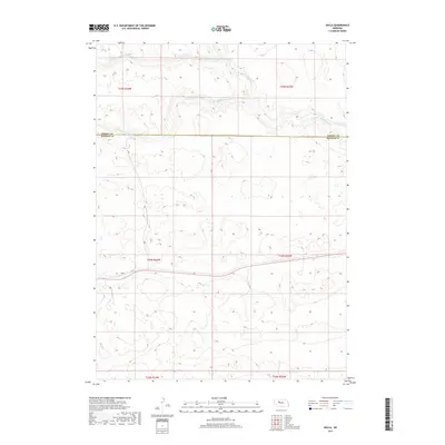
2017 Map of Hecla
USGS Topo · Published 2017About this map
Hecla sits at the heart of this Nebraska Sandhills landscape, where the braided channels of the Loup River system define the northern terrain. The map traces the convergence of the N Br Middle Loup River and the Middle Br Middle Loup River, forming the broader Middle Loup River as it winds through Hooker and Cherry counties. This area is characterized by high-relief dunes and numerous interdunal basins, reflecting the unique geomorphology of the region. The settlement of Hecla is positioned along the southern rail corridor, which follows the natural level topography south of the S Br Middle Loup River. The map provides a precise view of the land divisions across several townships, including t24n r34w and t25n r33w, illustrating the intersection of ranching boundaries and water resources in this part of the Great Plains.
Find a feature on this map
12 named features on this map. Tap any name to fly to it.
Don’t see what you’re looking for? This feature index may not catch every label — zoom into the map to look around manually.
Map Details
Editions of this 2017 Hecla Map
This is the sole edition of this map. No revisions or reprints were ever made.
Other maps of this area

1947 · Dismal River Ranch
USGS Topo · 1:62,500

1948 · Carr Lake
USGS Topo · 1:62,500

1948 · Mullen
USGS Topo · 1:62,500

1949 · Dismal River Ranch
USGS Topo · 1:62,500

1950 · Carr Lake
USGS Topo · 1:62,500

1950 · Hire
USGS Topo · 1:62,500

1951 · Mullen
USGS Topo · 1:62,500

1954 · North Platte
USGS Topo · 1:250,000

1956 · North Platte
USGS Topo · 1:250,000

1957 · North Platte
USGS Topo · 1:250,000