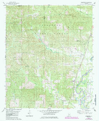
1980 Map of Heiberger
USGS Topo · Published 1985About this map
Talladega National Forest encompasses the northern half of this Perry County landscape, where the topography transitions from the high ridges of Cave Mountain down toward the southern lowlands. Small agricultural settlements and community hubs like Heiberger and Jericho define the local geography, connected by winding roads that lead to rural landmarks like Heiberger Sch. The mapping includes significant detail on local spiritual and family history, noting numerous country churches such as Bethlehem Ch, Mt Nebo Ch, and Pine Grove Ch, alongside the Bethesda Cem. The eastern border is shaped by the winding course of the Cahaba River, which gathers tributaries like Taylor Creek and Blue Girth Creek as it flows south. Scattered Gravel Pits indicate the small-scale extractive industry present during this 1980s revision.
Find a feature on this map
25 named features on this map. Tap any name to fly to it.
Don’t see what you’re looking for? This feature index may not catch every label — zoom into the map to look around manually.
Map Details
Editions of this 1980 Heiberger Map
2 editions found
Other maps of this area

1953 · Montgomery
USGS Topo · 1:250,000

1956 · Montgomery
USGS Topo · 1:250,000

1957 · Montgomery
USGS Topo · 1:250,000

1959 · Summerfield
USGS Topo · 1:62,500

1979 · Marion North
USGS Topo · 1:24,000

1979 · Morgan Springs
USGS Topo · 1:24,000

1979 · Harrisburg
USGS Topo · 1:24,000

1979 · Pondville
USGS Topo · 1:24,000

1980 · Payne Lake
USGS Topo · 1:24,000
1980 · Centreville West
USGS Topo · 1:24,000