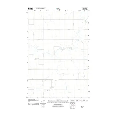
2011 Map of Heil
USGS Topo · Published 2011About this map
Heil sits at the heart of this North Dakota prairie landscape, organized by the rigid geometry of the Public Land Survey System. The small settlement is anchored by local history markers, including Prairie View Cemetery and Peace Cemetery, which reflect the community's heritage in southern Grant County. To the northwest, the prominent landform of Elm Butte rises above the surrounding plains, providing a significant navigational landmark in an area otherwise defined by wide-open spaces. The winding path of Antelope Creek meanders through the central and northern sections of the map, carving a natural contrast to the straight section lines of roads like 64th St SW and 61st Ave. This survey illustrates the persistent rural structure of the region, where isolated homesteads and cemeteries are connected by a vast network of gravel and section-line roads.
Find a feature on this map
19 named features on this map. Tap any name to fly to it.
Don’t see what you’re looking for? This feature index may not catch every label — zoom into the map to look around manually.
Map Details
Editions of this 2011 Heil Map
This is the sole edition of this map. No revisions or reprints were ever made.
Other maps of this area

1938 · Heart Butte
USGS Topo · 1:48,000

1944 · Heart Butte
USGS Topo · 1:62,500

1954 · Bismarck
USGS Topo · 1:250,000

1958 · Bismarck
USGS Topo · 1:250,000

1972 · Carson SE
USGS Topo · 1:24,000

1972 · Leith
USGS Topo · 1:24,000

1972 · Sheep Creek Dam
USGS Topo · 1:24,000
1980 · Lake Tschida East
USGS Topo · 1:24,000

1980 · Crown Butte Creek SE
USGS Topo · 1:24,000

1980 · Heil
USGS Topo · 1:24,000