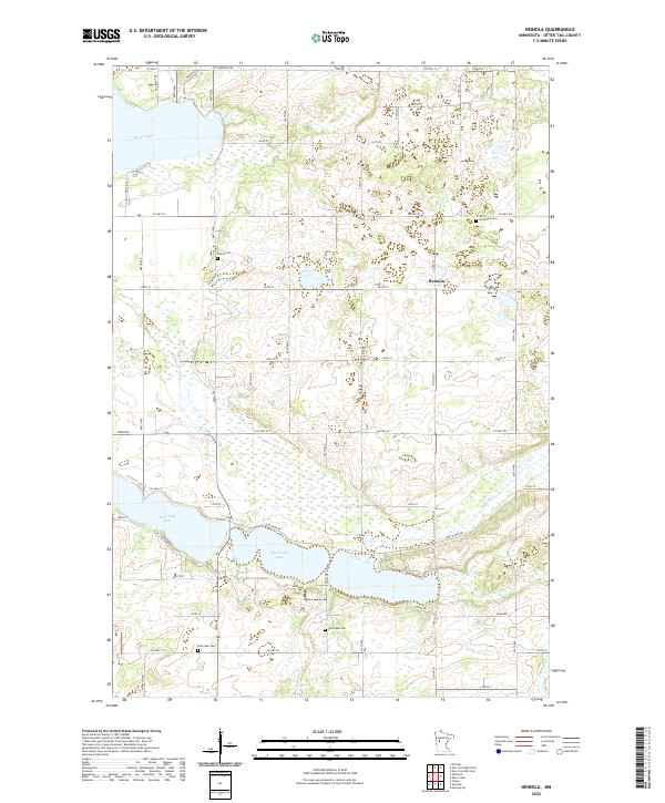
2022 Map of Heinola
USGS Topo · Published 2022About this map
The settlement of Heinola anchors this portion of Otter Tail County, a landscape defined by its complex glacial hydrology and rural road network. Significant water bodies like West Leaf Lake, East Leaf Lake, and Rush Lake dominate the terrain, connected by the Leaf River and its tributaries such as Willow Cr. This map captures a mature rural community with a clear sense of its local heritage, evident in the distribution of established burial grounds including Woodland Cem, Prairie Cem, and Leaf Lake Cem. The transition from the town of Henning at the western edge toward the agricultural interior is traced by a grid of county highways and local routes like Co Hwy 54 and Leaf River Rd. The map provides a detailed record of land use and drainage patterns in a region where the water and the land are inextricably linked.
Find a feature on this map
59 named features on this map. Tap any name to fly to it.
Don’t see what you’re looking for? This feature index may not catch every label — zoom into the map to look around manually.
Map Details
Editions of this 2022 Heinola Map
This is the sole edition of this map. No revisions or reprints were ever made.
Other maps of this area

1912 · Battle Lake
USGS Topo · 1:62,500

1914 · Battle Lake
USGS Topo · 1:62,500

1915 · Perham
USGS Topo · 1:62,500

1953 · Brainerd
USGS Topo · 1:250,000

1957 · Brainerd
USGS Topo · 1:250,000

1958 · Brainerd
USGS Topo · 1:250,000

1965 · Brainerd
USGS Topo · 1:250,000

1969 · Henning
USGS Topo · 1:24,000

1969 · Henning SE
USGS Topo · 1:24,000

1969 · Heinola
USGS Topo · 1:24,000