
1960 Map of Helena
USGS Topo · Published 1961About this map
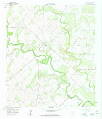
The Helena community, once the former county seat of Karnes County, is the focal point of this 1960 landscape. The settlement is positioned along a network of roads that converge near the Helena Cem and another smaller Cem, indicating the long-standing residential and ancestral roots of this South Texas prairie. The terrain is deeply defined by the winding course of the San Antonio River, which snakes through the center of the quadrangle, joined by tributaries like Ecleto Creek and McTannel Creek. This riparian network contrasts with the surrounding agricultural and industrial activity, evidenced by the presence of several Quarry sites and a series of Pipelines crossing the fields. Dominating the local topography to the west, Lookout Hill provides a distinct high point overlooking the river valley, marking a transition in the elevation of this rural ranching and farming district during the mid-twentieth century.
Find a feature on this map
9 named features on this map. Tap any name to fly to it.
Don’t see what you’re looking for? This feature index may not catch every label — zoom into the map to look around manually.
Map Details
Editions of this 1960 Helena Map
Other maps of this area

1920 · Smiley
USGS Topo · 1:125,000

1953 · Beeville
USGS Topo · 1:250,000

1953 · Seguin
USGS Topo · 1:250,000

1956 · Beeville
USGS Topo · 1:250,000

1956 · Karnes City
USGS Topo · 1:62,500

1958 · Seguin
USGS Topo · 1:250,000

1960 · Beeville
USGS Topo · 1:250,000
1960 · Karnes City
USGS Topo · 1:24,000

1960 · Kosciusko
USGS Topo · 1:24,000
1961 · Kenedy
USGS Topo · 1:24,000