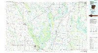
1984 Map of Helena
USGS Topo · Published 1985About this map
Crowleys Ridge rises above the alluvial plains of the Delta in this mid-1980s study of eastern Arkansas and northwest Mississippi. The landscape is defined by the shifting course of the Mississippi River and the dense network of drainage canals and bayous, including L'Anguille River and Big Creek. The St Francis National Forest occupies the southern reach of the ridge, anchoring a region of small farming settlements like Marianna, Marvell, and Moro.
Find a feature on this map
171 named features on this map. Tap any name to fly to it.
Don’t see what you’re looking for? This feature index may not catch every label — zoom into the map to look around manually.
Map Details
Editions of this 1984 Helena Map
This is the sole edition of this map. No revisions or reprints were ever made.
Other maps of this area

1908 · Lula
USGS Topo · 1:24,000

1908 · Dundee
USGS Topo · 1:24,000

1908 · Hollywood
USGS Topo · 1:24,000

1908 · Moon Lake
USGS Topo · 1:24,000

1908 · Walnut Lake
USGS Topo · 1:24,000

1908 · Lake Cormorant
USGS Topo · 1:24,000

1910 · Dundee
USGS Topo · 1:31,680

1910 · Walnut Lake
USGS Topo · 1:31,680

1912 · Lake Cormorant
USGS Topo · 1:31,680

1912 · Moon Lake
USGS Topo · 1:31,680