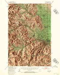
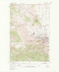
1950 Map of Helena
USGS Topo · Published 1954About this map
The Montana state Capitol stands at the eastern edge of this mid-century survey, anchoring the capital city of Helena as it sits at the base of Mt Helena. The landscape transitions abruptly from the dense urban grid and surrounding valley floor—home to landmarks like the St Joseph Orphan Home, County Hospital, and State Fairground—into the sharp rises of the Helena National Forest. To the west, the foothills are etched with the industrial and civic history of the region, including the Veterans Administration Center at Fort William Henry Harrison and a legacy of mineral extraction at the Dreadnaught Mine and Iron Ridge.
Find a feature on this map
60 named features on this map. Tap any name to fly to it.
Don’t see what you’re looking for? This feature index may not catch every label — zoom into the map to look around manually.
Map Details
Editions of this 1950 Helena Map
6 editions found

Other maps of this area

1886 · Fort Logan
USGS Topo · 1:250,000

1889 · Helena
USGS Topo · 1:250,000

1893 · Helena
USGS Topo · 1:250,000

1899 · Boulder
USGS Topo · 1:125,000

1899 · Helena
USGS Topo · 1:62,500

1899 · Helena
USGS Topo · 1:250,000

1903 · Helena
USGS Topo · 1:250,000

1947 · Butte
USGS Topo · 1:250,000

1948 · White Sulphur Springs
USGS Topo · 1:250,000

1950 · Jefferson City
USGS Topo · 1:62,500