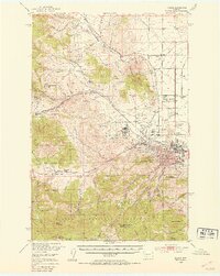
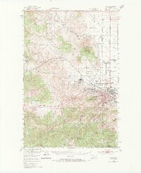
1950 Map of Helena
USGS Topo · Published 1954About this map
Helena and the surrounding gold-rush era landscape are detailed here just as the mid-century period solidified the capital city's modern layout. The map reveals the critical concentration of state and social institutions on the city's periphery, from the State Capitol to the Veterans Administration Center and the St Joseph Orphan Home. To the west, the military presence at Fort William Henry Harrison stands between the urban core and the high peaks of the Helena National Forest.
Find a feature on this map
72 named features on this map. Tap any name to fly to it.
Don’t see what you’re looking for? This feature index may not catch every label — zoom into the map to look around manually.
Map Details
Editions of this 1950 Helena Map
6 editions found

Other maps of this area

1886 · Fort Logan
USGS Topo · 1:250,000

1889 · Helena
USGS Topo · 1:250,000

1893 · Helena
USGS Topo · 1:250,000

1899 · Boulder
USGS Topo · 1:125,000

1899 · Helena
USGS Topo · 1:62,500

1899 · Helena
USGS Topo · 1:250,000

1903 · Helena
USGS Topo · 1:250,000

1947 · Butte
USGS Topo · 1:250,000

1948 · White Sulphur Springs
USGS Topo · 1:250,000

1950 · Jefferson City
USGS Topo · 1:62,500