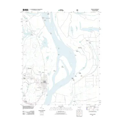
2011 Map of Helena
USGS Topo · Published 2011About this map
Helena-West Helena serves as the focal point of this riverfront survey, where the urban grid of Helena meets the expansive bends of the Mississippi River. The landscape is defined by the complex hydrology of the delta, featuring the Saint Francis River and the Kate Adams Chute. Local history is deeply etched into the terrain through numerous burial grounds, including the large Magnolia Cemetery, Maple Hill Cemetery, and Bethel Cemetery. Significant river engineering and navigation features are visible along the banks, such as the Prairie Point Dikes, Trotter Landing, and the Helena Revet. To the northwest, the elevation of the Crowley Ridge Overlook provides a rare vantage point over the bottomlands, while the Storm Creek Lake Campground highlights the area's recreational geography. This 2011 edition shows the modern extent of the city alongside traditional river landmarks like Prairie Point and Trotters Point.
Find a feature on this map
86 named features on this map. Tap any name to fly to it.
Don’t see what you’re looking for? This feature index may not catch every label — zoom into the map to look around manually.
Map Details
Editions of this 2011 Helena Map
This is the sole edition of this map. No revisions or reprints were ever made.
Other maps of this area

1908 · Lula
USGS Topo · 1:24,000

1908 · Dundee
USGS Topo · 1:24,000

1908 · Moon Lake
USGS Topo · 1:24,000

1910 · Dundee
USGS Topo · 1:31,680

1912 · Moon Lake
USGS Topo · 1:31,680

1912 · Lula
USGS Topo · 1:31,680

1932 · Marks
USGS Topo · 1:48,000

1935 · Marks
USGS Topo · 1:62,500

1939 · Clayton
USGS Topo · 1:62,500

1939 · Farrell
USGS Topo · 1:62,500
Featured Places
- Helena-West Helena, AR
- Eagle Landing, MS
- Jeffries, MS
- Helena, Helena-West Helena
- Helena Crossing, Helena-West Helena