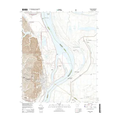
2014 Map of Helena
USGS Topo · Published 2014About this map
The Mississippi River defines the heart of this landscape, its shifting channels and chutes forming a complex border between Arkansas and Mississippi. On the western bank, the city of Helena-West Helena sits at the foot of the St. Francis National Forest, where the terrain rises sharply from the river bottomlands into the ridges of Crowley's Ridge. This 2014 survey documents the urban layout of neighborhoods like Oak Forest and Midland Heights, alongside significant educational institutions such as the Phillips Community Coll of the Univ of Arkansas.
Find a feature on this map
88 named features on this map. Tap any name to fly to it.
Don’t see what you’re looking for? This feature index may not catch every label — zoom into the map to look around manually.
Map Details
Editions of this 2014 Helena Map
This is the sole edition of this map. No revisions or reprints were ever made.
Other maps of this area

1908 · Lula
USGS Topo · 1:24,000

1908 · Dundee
USGS Topo · 1:24,000

1908 · Moon Lake
USGS Topo · 1:24,000

1910 · Dundee
USGS Topo · 1:31,680

1912 · Moon Lake
USGS Topo · 1:31,680

1912 · Lula
USGS Topo · 1:31,680

1932 · Marks
USGS Topo · 1:48,000

1935 · Marks
USGS Topo · 1:62,500

1939 · Clayton
USGS Topo · 1:62,500

1939 · Farrell
USGS Topo · 1:62,500
Featured Places
- Helena-West Helena, AR
- Eagle Landing, MS
- Jeffries, MS
- Helena, Helena-West Helena
- Helena Crossing, Helena-West Helena