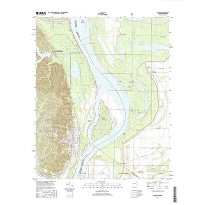
2017 Map of Helena
USGS Topo · Published 2017About this map
Helena sits as a vital river port along the Mississippi River at the edge of the St. Francis National Forest. This 2017 survey shows the city's complex interface between the elevated Crowley's Ridge and the sprawling river bottomlands. The town's educational and cultural anchor, the Phillips Community College of the University of Arkansas, is clearly situated near the industrial and residential corridors of Helena Crossing.
Find a feature on this map
118 named features on this map. Tap any name to fly to it.
Don’t see what you’re looking for? This feature index may not catch every label — zoom into the map to look around manually.
Map Details
Editions of this 2017 Helena Map
This is the sole edition of this map. No revisions or reprints were ever made.
Other maps of this area

1908 · Lula
USGS Topo · 1:24,000

1908 · Dundee
USGS Topo · 1:24,000

1908 · Moon Lake
USGS Topo · 1:24,000

1910 · Dundee
USGS Topo · 1:31,680

1912 · Moon Lake
USGS Topo · 1:31,680

1912 · Lula
USGS Topo · 1:31,680

1932 · Marks
USGS Topo · 1:48,000

1935 · Marks
USGS Topo · 1:62,500

1939 · Clayton
USGS Topo · 1:62,500

1939 · Farrell
USGS Topo · 1:62,500
Featured Places
- Helena-West Helena, AR
- Eagle Landing, MS
- Jeffries, MS
- Helena, Helena-West Helena
- Helena Crossing, Helena-West Helena