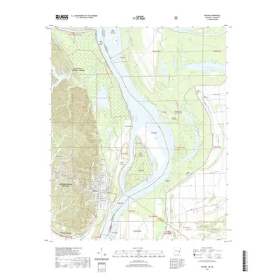
2020 Map of Helena
USGS Topo · Published 2020About this map
Helena-West Helena serves as the focal point of this Mississippi River landscape, where the urban grid of Helena meets the expansive waters of the Helena Reach. The city's civic and educational center is clearly defined by the Phillips County Courthouse and Phillips Community College. Along the riverbank, the shifting nature of the waterway is evident in features like Helena Towhead, Prairie Point Towhead, and Flower Lake Bar, illustrating the constant deposition and erosion that shapes the border between Arkansas and Mississippi.
Find a feature on this map
117 named features on this map. Tap any name to fly to it.
Don’t see what you’re looking for? This feature index may not catch every label — zoom into the map to look around manually.
Map Details
Editions of this 2020 Helena Map
This is the sole edition of this map. No revisions or reprints were ever made.
Other maps of this area

1908 · Lula
USGS Topo · 1:24,000

1908 · Dundee
USGS Topo · 1:24,000

1908 · Moon Lake
USGS Topo · 1:24,000

1910 · Dundee
USGS Topo · 1:31,680

1912 · Moon Lake
USGS Topo · 1:31,680

1912 · Lula
USGS Topo · 1:31,680

1932 · Marks
USGS Topo · 1:48,000

1935 · Marks
USGS Topo · 1:62,500

1939 · Clayton
USGS Topo · 1:62,500

1939 · Farrell
USGS Topo · 1:62,500
Featured Places
- Helena-West Helena, AR
- Eagle Landing, MS
- Jeffries, MS
- Helena, Helena-West Helena
- Helena Crossing, Helena-West Helena