
1950 Map of Helena
USGS Topo · Published 1950About this map
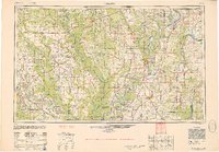
The Mississippi River and its labyrinthine oxbow lakes define the eastern portion of this mid-century landscape, where the major waterway separates Arkansas from Mississippi. Centered on the river port of Helena, the map illustrates a complex delta environment where the St Francis River and White River converge toward the larger channel. To the west, the elevated terrain of Crowleys Ridge and the broad Grand Prairie provide a distinct geological contrast to the alluvial lowlands.
Find a feature on this map
226 named features on this map. Tap any name to fly to it.
Don’t see what you’re looking for? This feature index may not catch every label — zoom into the map to look around manually.
Map Details
Editions of this 1950 Helena Map
2 editions found
Other maps of this area

1891 · Little Rock
USGS Topo · 1:125,000

1893 · Little Rock
USGS Topo · 1:125,000

1908 · Lula
USGS Topo · 1:24,000

1908 · Dundee
USGS Topo · 1:24,000

1908 · Hollywood
USGS Topo · 1:24,000

1908 · Coahoma
USGS Topo · 1:24,000

1908 · Moon Lake
USGS Topo · 1:24,000

1908 · Jonestown
USGS Topo · 1:24,000

1908 · Walnut Lake
USGS Topo · 1:24,000

1908 · Lake Cormorant
USGS Topo · 1:24,000