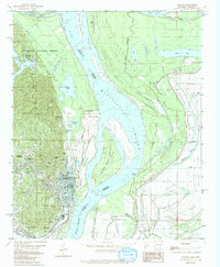
1982 Map of Helena
USGS Topo · Published 1982About this map
The Mississippi River and its shifting landscape dominate this 1982 survey of the Arkansas-Mississippi border. The river's path is marked by substantial geographic features like Helena Island NO 60, Prairie Point Towhead, and the massive Flower Lake Bar, illustrating the dynamic nature of the waterway. On the western bank, the city of Helena and neighboring West Helena sit against the eastern edge of Crowleys Ridge, where the steep terrain of the St Francis National Forest rises sharply from the alluvial plain.
Find a feature on this map
55 named features on this map. Tap any name to fly to it.
Don’t see what you’re looking for? This feature index may not catch every label — zoom into the map to look around manually.
Map Details
Editions of this 1982 Helena Map
This is the sole edition of this map. No revisions or reprints were ever made.
Other maps of this area

1908 · Lula
USGS Topo · 1:24,000

1908 · Dundee
USGS Topo · 1:24,000

1908 · Moon Lake
USGS Topo · 1:24,000

1910 · Dundee
USGS Topo · 1:31,680

1912 · Moon Lake
USGS Topo · 1:31,680

1912 · Lula
USGS Topo · 1:31,680

1932 · Marks
USGS Topo · 1:48,000

1935 · Marks
USGS Topo · 1:62,500

1939 · Clayton
USGS Topo · 1:62,500

1939 · Farrell
USGS Topo · 1:62,500
Featured Places
- Helena-West Helena, AR
- Trotter Landing, MS
- Eagle Landing, MS
- Midland Heights, Helena-West Helena
- Helena, Helena-West Helena