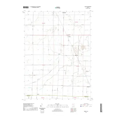
2019 Map of Helena
USGS Topo · Published 2019About this map
Gibsonburg and Helena anchor this part of Sandusky County, where a complex network of drainage ditches and creeks defines the agricultural landscape. The map illustrates a highly organized grid of rural roads, such as Quinshan Rd and Rising Sun-Tinney Rd, that connect small settlements like Millersville, Tinney, and Burgoon. Water management is central to the area's layout, with Gries Ditch and Flechtner Ditch augmenting natural waterways like Muddy Cr and Muskellunge Cr. Genealogists will find significant value in the distribution of local burial sites, including Saint Marys Cem near Millersville and the Trinity Cem south of Girton. The southern edge of the survey transitions into Seneca County at Seneca Co Line Rd, marking the boundary of the Squires area.
Find a feature on this map
46 named features on this map. Tap any name to fly to it.
Don’t see what you’re looking for? This feature index may not catch every label — zoom into the map to look around manually.
Map Details
Editions of this 2019 Helena Map
This is the sole edition of this map. No revisions or reprints were ever made.
Other maps of this area

1901 · Fostoria
USGS Topo · 1:62,500

1901 · Fremont
USGS Topo · 1:62,500

1901 · Elmore
USGS Topo · 1:62,500

1903 · Fremont
USGS Topo · 1:62,500

1903 · Fostoria
USGS Topo · 1:62,500

1903 · Elmore
USGS Topo · 1:62,500

1906 · Tiffin
USGS Topo · 1:62,500

1956 · Toledo
USGS Topo · 1:250,000
1957 · Lindsey
USGS Topo · 1:24,000

1958 · Fremont West
USGS Topo · 1:24,000