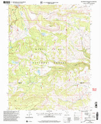
2001 Map of Heliotrope Mountain
USGS Topo · Published 2004About this map
The crest of the Wasatch Plateau defines this high-elevation landscape within the Manti-La Sal National Forest. Much of the terrain is shaped by the presence of Heliotrope Mountain, which stands as a central landmark overlooking high meadows like Horse Heaven and Peavine Flat. The area is characterized by a significant water management network, evidenced by numerous high-altitude catchments including Henningson Reservoir, Spinners Reservoir, and the Julius Flat Reservoir.
Find a feature on this map
38 named features on this map. Tap any name to fly to it.
Don’t see what you’re looking for? This feature index may not catch every label — zoom into the map to look around manually.
Map Details
Editions of this 2001 Heliotrope Mountain Map
This is the sole edition of this map. No revisions or reprints were ever made.
Other maps of this area

1885 · Manti
USGS Topo · 1:250,000

1885 · Fish Lake
USGS Topo · 1:250,000

1895 · Manti
USGS Topo · 1:250,000

1896 · Fish Lake
USGS Topo · 1:250,000

1922 · Wasatch
USGS Topo · 1:31,680

1925 · Acord Lakes
USGS Topo · 1:62,500

1956 · Salina
USGS Topo · 1:250,000

1956 · Price
USGS Topo · 1:250,000

1960 · Price
USGS Topo · 1:250,000

1960 · Salina
USGS Topo · 1:250,000