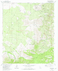
1981 Map of Helvetia
USGS Topo · Published 1981About this map
The Santa Rita Mountains define this landscape, where mining activity once centered around the Helvetia townsite. By the early 1980s, the area remained a network of historic claims and operational remains, including the Helvetia Cem and numerous named prospects like the Bulldozer Mine and Gunsight Mine. The northern half of the map is dominated by the Santa Rita Experimental Range and Wildlife Area, illustrating a transition from extractive industry to land management and conservation.
Find a feature on this map
67 named features on this map. Tap any name to fly to it.
Don’t see what you’re looking for? This feature index may not catch every label — zoom into the map to look around manually.
Map Details
Editions of this 1981 Helvetia Map
2 editions found
Other maps of this area

1904 · Patagonia
USGS Topo · 1:125,000

1905 · Patagonia
USGS Topo · 1:125,000

1922 · Agus Caliente
USGS Topo · 1:62,500

1926 · Helvetia
USGS Topo · 1:62,500

1932 · Elgin
USGS Topo · 1:62,500

1940 · Elgin
USGS Topo · 1:62,500

1947 · Elgin
USGS Topo · 1:62,500

1948 · Sonoita
USGS Topo · 1:24,000

1956 · Nogales
USGS Topo · 1:250,000

1958 · Nogales
USGS Topo · 1:250,000